Biodiversity Net Gain Oxfordshire: Expert BNG Reports & Ecological Surveys
Since the introduction of the Environment Act 2021, biodiversity net gain (BNG) has become a mandatory requirement across England, and Oxfordshire is no exception. From February 2024, most planning applications in the county must demonstrate a minimum ten per cent uplift in biodiversity, calculated using the government’s statutory Biodiversity Metric.
This applies to developments across the region, from urban expansion in Oxford and Banbury to smaller rural schemes in the Cotswolds and along the Thames Valley. The planning process requires developers to establish the baseline ecological value of their site, forecast biodiversity levels post-development, and set out how the mandatory uplift will be delivered.
Where on-site provision cannot meet the requirement in full, biodiversity units must be secured off-site within Oxfordshire or, as a final resort, statutory biodiversity credits may be purchased.
Ecological Priorities and Special Sites in Oxfordshire
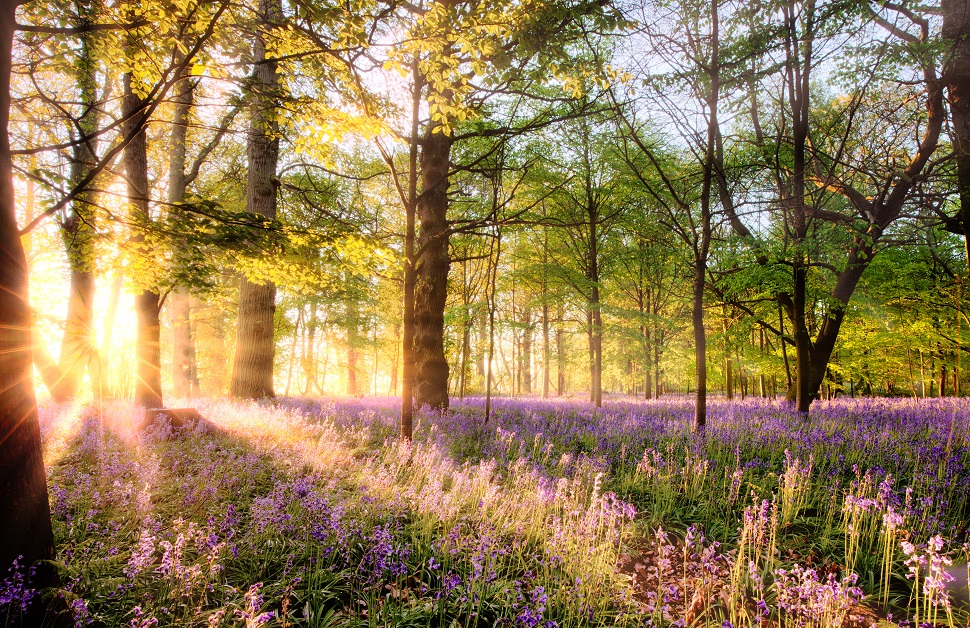
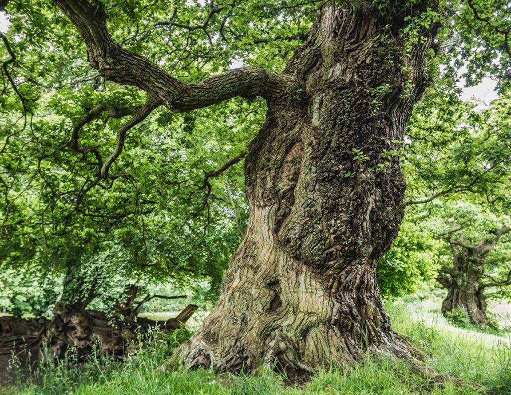
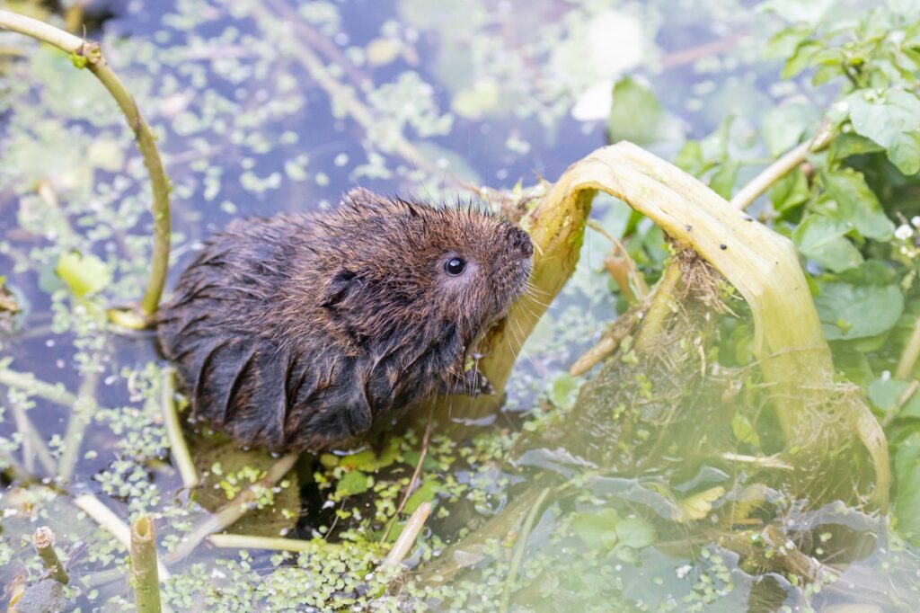
Oxfordshire is known for its rich natural environment, with habitats ranging from chalk grasslands and floodplain meadows to ancient woodlands and wetland ecosystems. The county contains sites of national and international ecological importance, including Otmoor, Wytham Woods, Cothill Fen Special Area of Conservation (SAC), and the River Thames and Cherwell floodplains. These areas provide crucial habitats for species such as bats, otters, great crested newts, water voles, and breeding waders.
The Oxfordshire Local Nature Recovery Strategy highlights priority habitats including species-rich grasslands, wetlands, hedgerows and woodland networks. The county’s planning authorities expect biodiversity net gain reports to reflect these ecological priorities and to contribute to wider landscape connectivity, particularly in relation to river corridors and ancient woodland linkages.
Preparing a BNG Report in Oxfordshire
A BNG report in Oxfordshire, south east England, begins with a pre development baseline ecological survey. This involves identifying and recording existing habitats on a development site, assessing their condition, and mapping the site’s ecological value. Development proposals are then measured against this baseline using the Biodiversity Metric to forecast post-development outcomes.
If calculations indicate that the ten per cent target will not be reached, ecologists will recommend measures to enhance habitats, plant new habitats, or off-site measures to achieve compliance.
Because of Oxfordshire’s varied ecological landscape, many sites require additional surveys for priority habitats. Great crested newts are common in pond-rich areas, particularly in the north of the county, while bat surveys are frequently necessary given the presence of woodland, hedgerows and older buildings. These surveys are often integrated into the BNG process, ensuring that developments meet both BNG legislation and species protection laws.

Delivering BNG Across Oxfordshire
The preferred approach is always to deliver bng on-site. In Oxfordshire, this can include the creation of wildflower meadows, hedgerow planting, woodland restoration, or wetland enhancement along river valleys.
Where on-site measures alone are insufficient, developers may turn to off-site biodiversity units, ideally located on designated sites within Oxfordshire to ensure local ecological benefits. Statutory biodiversity credits are considered only when no other options are available.
Protected Species and BNG Requirements
Oxfordshire’s biodiversity means that protected species considerations often overlap with the BNG process. Bat roosts, great crested newts, water voles and breeding birds are regularly encountered, meaning that careful planning and surveys are essential. Work to protect and create newt habitats is often monitored by the Newt Conservation Partnership.
Early integration of these assessments before there is any work started avoids delays and ensures that biodiversity net gain measures align with the wider mitigation hierarchy, which prioritises avoiding impacts before moving to minimising harm, restoration and compensation.
What a Biodiversity Net Gain BNG Plan Involves
BNG plans set out how a development will achieve measurable ecological improvements to support planning applications. This includes the results of the baseline habitat survey, statutory Biodiversity Metric calculations, proposed habitat creation and enhancement measures, and a thirty-year management strategy to secure long-term benefits.
Oxfordshire’s local planning authorities also expect BNG plans to demonstrate a clear contribution to county priorities, particularly the restoration of floodplain meadows, grassland habitats, and woodland connectivity.
Expert Support for Planning Applications in Oxfordshire
Our team of experienced ecologists delivers biodiversity net gain bng reports in Oxfordshire for both small schemes and major developments that are seeking planning permission. We provide baseline surveys, Biodiversity Metric calculations, habitat creation advice and long-term ecological management plans. We also support clients in securing off-site biodiversity units or conservation covenants where required and will monitor applications through the planning system.
Request a Free Quote for a Biodiversity Net Gain BNG Report in Oxfordshire
If you need a BNG assessment in Oxfordshire, our ecologists can prepare a clear and fully compliant report tailored to your site and development. From the first survey to final submission for planning permission, we ensure that your project meets the statutory ten per cent uplift and leaves the natural environment in a better condition.
For a free quote, contact us with your site address and details of your development. By incorporating biodiversity net gain bng at an early stage, you will comply with the Environment Act, Natural England and government guidance, and give planning applications their best chance of success.